


Hamilton township voting district 6, Atlantic County, New Jersey
About
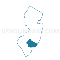
Outline

Summary
| Unique Area Identifier | 616611 |
| Name | Hamilton township voting district 6 |
| County | Atlantic County |
| State | New Jersey |
| Area (square miles) | 35.63 |
| Land Area (square miles) | 34.98 |
| Water Area (square miles) | 0.65 |
| % of Land Area | 98.18 |
| % of Water Area | 1.82 |
| Latitude of the Internal Point | 39.54418130 |
| Longtitude of the Internal Point | -74.78033990 |
Maps


Graphs
Select a template below for downloading or customizing gragh for Hamilton township voting district 6, Atlantic County, New Jersey


Neighbors
Neighoring Voting District (by Name) Neighboring Voting District on the Map
- Buena Vista township voting district 1, Atlantic County, NJ
- Buena Vista township voting district 3, Atlantic County, NJ
- Folsom borough voting district 1, Atlantic County, NJ
- Hamilton township voting district 1, Atlantic County, NJ
- Hamilton township voting district 2, Atlantic County, NJ
- Hamilton township voting district 3, Atlantic County, NJ
- Hamilton township voting district 5, Atlantic County, NJ
- Hammonton town voting district 1, Atlantic County, NJ
- Mullica township ward 1 voting district 1, Atlantic County, NJ
Top 10 Neighboring County Subdivision (by Population) Neighboring County Subdivision on the Map
- Hamilton township, Atlantic County, NJ (26,503)
- Hammonton town, Atlantic County, NJ (14,791)
- Buena Vista township, Atlantic County, NJ (7,570)
- Mullica township, Atlantic County, NJ (6,147)
- Folsom borough, Atlantic County, NJ (1,885)
Top 10 Neighboring Place (by Population) Neighboring Place on the Map
Top 10 Neighboring Elementary School District (by Population) Neighboring Elementary School District on the Map
- Hamilton Township School District, NJ (26,503)
- Mullica Township School District, NJ (6,147)
- Folsom Borough School District, NJ (1,885)
Top 10 Neighboring Secondary School District (by Population) Neighboring Secondary School District on the Map
Top 10 Neighboring Unified School District (by Population) Neighboring Unified School District on the Map
Top 10 Neighboring State Legislative District Lower Chamber (by Population) Neighboring State Legislative District Lower Chamber on the Map
- General Assembly District 9, NJ (236,923)
- General Assembly District 2, NJ (234,905)
- General Assembly District 1, NJ (217,333)
Top 10 Neighboring State Legislative District Upper Chamber (by Population) Neighboring State Legislative District Upper Chamber on the Map
- State Senate District 9, NJ (236,923)
- State Senate District 2, NJ (234,905)
- State Senate District 1, NJ (217,333)
Top 10 Neighboring 111th Congressional District (by Population) Neighboring 111th Congressional District on the Map
Top 10 Neighboring Census Tract (by Population) Neighboring Census Tract on the Map
- Census Tract 112.02, Atlantic County, NJ (7,570)
- Census Tract 115, Atlantic County, NJ (6,592)
- Census Tract 107, Atlantic County, NJ (6,147)
- Census Tract 114.01, Atlantic County, NJ (4,759)
- Census Tract 110, Atlantic County, NJ (2,666)
- Census Tract 112.01, Atlantic County, NJ (1,885)
Top 10 Neighboring 5-Digit ZIP Code Tabulation Area (by Population) Neighboring 5-Digit ZIP Code Tabulation Area on the Map
- 08330, NJ (28,167)
- 08037, NJ (24,308)
- 08215, NJ (13,442)
- 08310, NJ (1,670)
- 08346, NJ (843)
- 08350, NJ (825)